Uttar Pradesh Bhulekh, Khasra, Khatoni, Bhulekh Online Land Verification : Bhulekh UP is a digital portal for land records launched by the Revenue Council of Government of Uttar Pradesh. Before the introduction of Bhulekh UP, all the task related to the record of land such as Khatauni system, Jamabandi, etc. were done recording manually on papers. But now UP Government has computerized all the land record activities in the state.
UP Bhulekh 2019
Earlier record keeping of land was done manually at the Revenue Board. Citizens have to visit the department for every task related to their land. For each and every task related to land such as sale of land, imitation of khatauni, unique code, jamabandi etc. They have to visit the govt. office for viewing even a single information of land account. It was very time consuming and sometimes did not give satisfactory results. But, now scenario has been changed and Uttar Pradesh government has computerized the land record system.
How to check UP Land Records Online?
Bhulekh UP is an online portal and most of the people do not know how it works and how they can use it to check the land records. If you are one of them, then you do not have to worry. Here we have shared a step by step procedure to check the land records to help you in this.
You can check the imitation of Khatauni (Khatauni ki nakal) on Bhulekh by following the procedure shared below. To make it easy for you we have explained the complete procedure with help of pictures.
- Go to official website
For this, you need to visit the official portal of Bhulekh UP i.e. http://upbhulekh.gov.in.
- Open the Below link
On the homepage of the portal, you will see various links. You have to click on “See imitation of Khatoni (rights record)” link.
- Enter the captcha code
A dialog will appear and you have to enter the shown captcha code. Before you click on submit button, you must ensure that you have entered the code correctly as it is case sensitive.
- Select the district
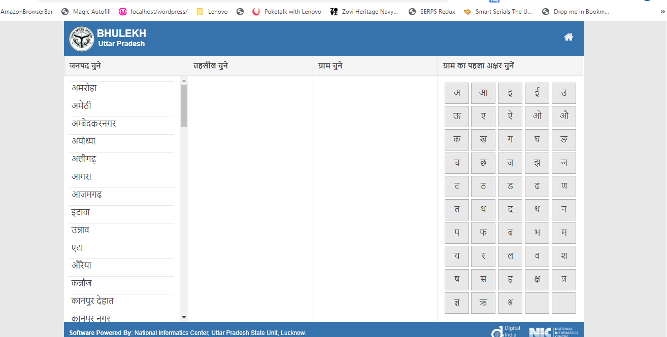
Now, you have to choose the district from the list as shown in the picture.
- After Selecting district Select tehsil
On selecting a district, a list of all the tehsils falling under that district will appear. You have to select the respective tehsil from the list.
- Select village
Once you have selected the tehsil a list of village will appear and you have to select your village. You can make it easy by selecting the first letter of your village from the option given below.
- Enter credentials
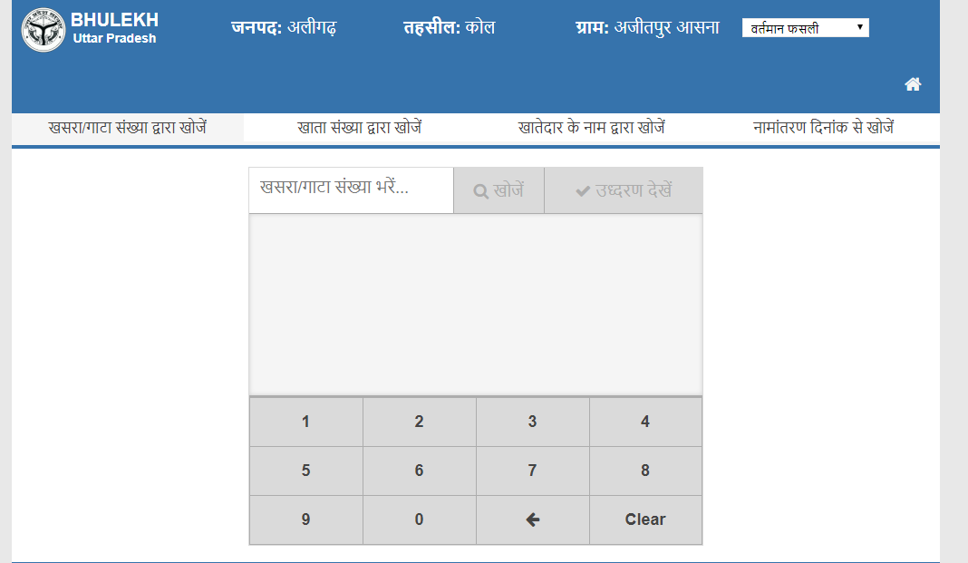
Now you have to enter the valid information in the space provided. You are given three option to search. You can search by entering the Gata No./ measles or by account No. or by the name of the account holder.
After entering the valid credentials, you have to click on “See Evaluation” button. - Check the account details
Now, you can see the details of your account on your screen. It includes information such as name of the account holder, crop year, district, area, land record number, order, area etc.
- Save the details
Lastly, if you wish you can save the page or can take a screenshot for references. However, details about your land are already in the database and you can check it anywhere, any time when you need it.
UP Bhu Naksha
Citizen can also check the online map of Uttar Pardesh. UP Bhu Naksha 2019 link is provided here. Click on the link to visit the Bhulekh UP online map/naksha.
Uttar Pradesh Geo Map Online: you can see a map of your own land farm online sitting at home. You can also take a printout of your land map. Uttar Pradesh’s Chief Minister Yogi Adityanath has introduced an online map of the country by making map material information online.
How to View UP Bhu Naksha online
- Click on this website: http://164.100.163.165/bhunaksha/09/index.html
- Now select the district, tehsil, and village.
- You will now see a map of the area selected.
- Now you can click on your farm number to see the name of the account holder concerned.
- After doing this, you will see account number, now select the account holder’s name which you want to see.
- You can also take print out of the land map.


